
CTUC Map: Sierra National Forest: High Sierra Ranger District
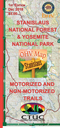
CTUC Map: Stanislaus National Forest & Yosemite National Park
This full color regional map of the Sequoia National Forest's OHV and hiking trails on lands of the Forest Service and National Parks. (1st Edition, December 2018)

FOEM Map: BLM Barstow North & Death Valley National Park
The Friends of El Mirage map covers the Dumont Dunes OHV Open Area, Barstow areas, Death Valley National Park, and surrounding areas. (1st Edition, March 2019)

FOEM Map: BLM Barstow, Big Bear, & Johnson Valley
This map includes, Rainbow Basin, Stoddard and Johnson Valley OHV Open Areas, and Big Bear Recreation area. (6th Edition, October 2021)

FOJ Map: Jawbone Canyon & BLM Ridgecrest Area
The Friends of Jawbone map covers the Jawbone OHV Open Area, Dove Springs Open Area, Jawbone Canyon, The El Paso Mountains and the Historic Rand Mountains and surrounding areas. (14th Edition, May 2021)
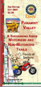
FOJ Map: Panamint Valley OHV Map
The Panamint Valley map covers the Slate Range, Panamint Mountains, the Death Valley National Park and surrounding areas. (2nd Edition, October 2021)